Glasgow: Hyndland/Hughenden and Dowanhill West, Proposed Parking Controls, Exhibition, 30 October to 06 November

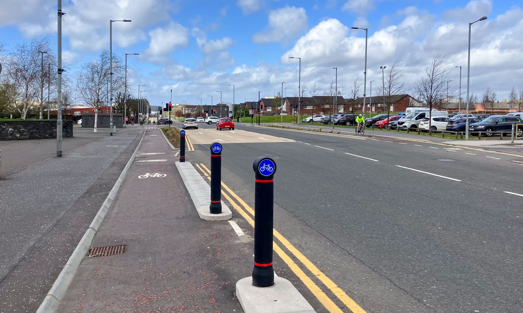
We have been made aware of this open consultation event.  Controlling car parking is critical, but we must ensure that it is not done at the expense of permeability for cycling, thus discouraging active travel.  Contraflow cycling lanes are becoming common throughout the city; Gordon Street, Dalnair Street and West Princes Street are just a few examples.  If streets that are currently two-way are proposed for one-way to allow the storage of motor vehicles on both sides without exempting bikes, as has happened in Dowanhill East, then please object.  The relevant part of the City Council’s design guide, Cycling by Design is clause 5.1.5

If you live in, work in, or travel through this area, do please get along to the consultation:

HYNDLAND / HUGHENDEN AND DOWANHILL WEST 

PROPOSED PARKING CONTROLS

PUBLIC CONSULTATION EXHIBITION – Venue: PARTICK LIBRARY

Exhibition Open to View from Monday 30 October to Monday 6 November 2017

On the following dates, council staff will also be present to answer queries & discuss proposals.

  • Tuesday 31 October, 10am to 4pm
  • Thursday 2 November, 10am to 6pm
  • Friday 3 November, 10am to 4pm

===========================================

Glasgow City Council are writing to inform you of the commencement of a voluntary consultation for the proposed Hyndland, Hughenden and Dowanhill West area parking controlled zone prior to the commencement of the statutory traffic regulation order (TRO) process.

Glasgow City Council is currently undertaking the development and introduction of significant parking control schemes throughout the Glasgow area.  This includes Hillhead, Garnethill and the Partick area.  Due to its scale, the Partick area has been split into separate schemes to facilitate the traffic regulation order (TRO) promotion and implementation process namely Partick, Hyndland/Hughenden, Dowanhill West areas and the Dumbarton Road/Argyle Street corridor.

The West End of Glasgow has excellent bus, train and subway transport links which unfortunately attracts commuters driving to the area and using the residential streets to park‑and‑ride resulting in the kerbside road space being sterilised by all day parking with indiscriminate and obstructive parking practices commonplace.  The introduction of parking controls is an effective way of managing the demand for the finite road space available by preventing all day parking thus reducing the traffic attracted to the area whilst increasing the turnover of parking spaces and improving the safety and traffic flow. Parking controls also maintains access for emergency service, refuse collection and delivery vehicles etc. and also assists the Council in undertaking routine road maintenance such as channel and gully cleaning work and road/ footway repairs.

Prior to the commencement of statutory traffic order process for the Hyndland, Hughenden and Dowanhill West schemes the Council is holding a public exhibition in Partick Library from Monday 30 October to Monday 6 November 2017. Council Officers will be in attendance to answer queries and discuss proposals on Tuesday 31 October, Thursday 2 November and Friday 3 November, as stated above.

A letter will be issued to all affected addresses within the proposed zone providing a brief summary of the proposals and will also inform of the public exhibition. 

Pre-meeting Info – Statutory Process for Parking Restrictions

Pre-meeting Info – Glasgow City Councils Local Transport Strategy in relation to Parking

Pre-meeting Info – Existing Parking Zones within Glasgow


Glasgow Councillor Tour 9, Thursday 19 October, Ward 23, Partick East / Kelvindale, Walking Tour with Green Councillor, Martin Bartos

On the evening of Thursday 19 October, GoBike Convenor, Tricia Fort, and member, Johnston Orr, met with Councillor Martin Bartos, for a short walking tour of Ward 23, Partick East/Kelvindale.  We took more or less the same route that we had covered with the other 3 councillors for the ward, from near Byres Road along Highburgh/Hyndland Road to Great Western Road and we walked because Martin is not yet back on his bike following a collision with a taxi some time ago.  This is the only ward where all 4 councillors have met with us, setting a great example to all the other wards!  Johnston and Martin are pictured below:

From east to west, our discussion covered, first of all, Byres Road, which is currently being considered for redevelopment.  Martin is concerned at the lack of ambition being shown in the current Glasgow City Council proposals.  We have thus put him in touch with the GoBike grouping that is developing alternative proposals, see: https://space4peoplebyresroad.wordpress.com/2017/10/20/our-vision/ and the photo at the top of this blog is option 2 showing local access and a bus route with cycle lanes both sides.  Remember that there’s a ride-out tomorrow along the route – details in the link.

Our next point of discussion was the lack of access into Dowanhill for bikes from Highburgh Road.  Caledon Street, Dowanhill Street, Beaumont Gate and Hyndland Street are all one-way southwards with no exception for cycles and the only legal option is to turn right into Crown Road South – which is on a bend, and it’s a busy road.  Contraflow cycling on one-way streets is the default position in Cycling by Design (clause 5.i.5), the City Council’s chosen design guide, so why doesn’t it apply here, where there is a toucan crossing to aid the passage of people with bikes up Dowanhill Street?  It should also be noted that contraflow cycling would reduce traffic speeds on these streets.

Third, we noted the good intention of providing disabled parking bays, also noted on our walking tour with Councillors Kenny McLean and Martin Rhodes, which extend right out to the cycle lane – potentially increasing the number of disabled people in the area!

Fourth, we looked at the buildout at the end of the row of shops on Hyndland Road.  The eastbound painted cycle lane, missing since the junction with Clarence Drive, reappears here, right on the bend and just at the pinch point where the road is at its narrowest.  The buildout has been put in place apparently to provide 2 loading bays, which are being misused as parking bays – just where the cycle lane could have been.

Fifth, we noted the blockage in the access provided to Prince Albert Road; why is no action taken against parking at all these cycle accesses?

Sixth, we discussed the potential of access via Hughenden Lane to the sports facilities and Gartnavel Hospital and points further west.

Seventh, we looked at the junction of Hyndland Road with Great Western Road, a scene of constant red-light jumping by cars and constant misuse of the left-turning lane to go straight on to Clevedon Road.  Why is no action taken to remedy this?

A further point of discussion was the type of cycle facility needed to encourage cycling.  While a segregated cycle lane is needed on either side of Great Western Road, which is a major route into the city, a two-way segregated cycle lane would be far better than the current position on Hyndland/Highburgh Road if the Council persists in allowing the storage of private property (colloquially known as car parking) on the road but reduces it to one side only.

Martin asked about traffic evaporation when roads are closed to motor vehicles, or when access is reduced, and Johnston has provided this information:

“The economic case for building cycle lanes – https://www.citylab.com/life/2013/12/safer-streets-pay-businesses/7880/ from 2013 and a pretty comprehensive roundup from 2015 https://www.citylab.com/solutions/2015/03/the-complete-business-case-for-converting-street-parking-into-bike-lanes/387595/

Closing roads to cars and traffic evaporation – the Wikipedia page on Induced Demand is a good place to start as it leads into a section on traffic evaporation https://en.m.wikipedia.org/wiki/Induced_demand and the academic study referencing UK cases (I was wrong, there are some!) – https://web.wpi.edu/Pubs/E-project/Available/E-project-051109-062746/unrestricted/D09_Traffic_Final_Report.pdf and the same studies referenced by the EU paper at http://ec.europa.eu/environment/pubs/pdf/streets_people.pdf

Plenty to digest there, and some of it is heavyweight stuff, so maybe try this news article on what Paris is doing right now for some real-world evidence from a European city’s current policy decisions – https://www.fastcompany.com/3064157/when-paris-closed-a-major-road-to-cars-half-its-traffic-just-disappeared

Glasgow Councillor Tour 8, Ward 6, Pollokshields, with Green Party Councillor, Jon Molyneux, Thursday 19 October 2017

On the afternoon of Thursday 19 October, Councillor Jon Molyneux, Green Party, met GoBike convenor, Tricia Fort and GoBike members, Bill Fraser, who is also on Pollokshields Community Council, Bob Downie and Nick Kempe for a cycle tour of Ward 6.  We were waved off from Pollokshaws Road at Shawlands Cross by Baillie Hanif Raja, Labour Party, who doesn’t cycle but wished us well.

Details of the route planned for us by GoBike ride leader, Andy Preece are given here: Councillor Ward Tour – Pollokshields map and his notes are here: Councillor Ward Tour – Pollokshields  We deviated slightly from the route and the actual route is shown here: 

So, what did we notice apart from the information given in Andy’s notes?  We left our meeting point on Pollokshaws Road, the most heavily cycled route in Glasgow, that has next to no cycle facilities and went along Moss-Side Road, past Shawlands Academy.  There were cars parked right along, with no sign of any assistance for parents or pupils who might want to cycle to school.  We made our way over the railway at Crossmyloof Station, with only an Advance Stop Line for anyone who wants to cycle to Hutchesons’ Grammar School, and down into Titwood Road.

Springkell Avenue is a wide, quiet road, where all the houses have gardens and driveways – so why do they park on the road?  We then came to this, where apparently a nearby housing development is having an adverse effect on the railway bridge:

Yes, there was room to get through on our bikes, so why isn’t it signed for bikes as well as pedestrians?  Where’s the permeability?

At the end of Springkell Avenue, a pleasure to cycle on, we came to the path down to Dumbreck Road.  Apart from the spreading vegetation over the path, there is no lighting on this path, nor on the section that goes all the way to Nithsdale Road – not a winter commuter route then!  At Dumbreck Road we joined the carriageway; a tricky manoeuvre since the toucan crossing and lights seem to assume that someone on a bike will be going into Pollok Park not over the motorway towards Bellahouston Park.  We checked out the exit from Bellahouston Park, thinking that quite a few families from the area might want to cycle to and from it.  The only crossing over Dumbreck Road is a pedestrian one; there is no traffic signal for cars or bikes exiting the park.

As the picture shows, there are no cycle facilities on NIthsdale Road, a useful route across to the east of the ward, and with 2 lanes of traffic coming towards Dumbreck Road, it’s quite a narrow access for bikes as well as cars.  Later, we turned into Maxwell Drive, where cars park right over the painted cycle lanes, or are parked so close to the cycle lane that an opening door could seriously damage a bike and its rider.

We made our way to Albert Drive where the Community Council has put much effort into trying to prevent cars being parked at street corners.  Double yellow lines have been painted on them all, but they are not mandatory until the necessary signs are in place.  The signs are not in place – what an omission by the City Council!

On the eastern end of Albert Drive, we came upon a car parked on the cycle lane and then the cycle lane disappeared under a road narrowing scheme designed to protect the weak railway bridge:

So, one wonders, why wasn’t the bike lane continued, but with segregation, to narrow the road?  Where are people on bikes supposed to go?  Into the narrow roadway or on the footway?  After this point the cycle lanes disappear again under parked cars.

We took a left on Barrland Street to avoid the busy Pollokshaws Road but we did go to the eastern end of Maxwell Road, where there are no formal dropped kerbs to Pollokshaws Road but tarmac ramps were made for a running race a couple of years ago.  Fortunately, they have not been removed.

The Community Council, we heard, are working towards improving Maxwell Road by liaising with house-builders and improving the parking situation.

We took a look at Forth Street, the home of Soul Riders, where recent parking changes included making the street one-way, and not exempting bikes.  So, it’s either a long detour or a technically illegal ride on the footway to get to their premises.  Where is the encouragement to cycle?  Where is the permeability?

At the new school on St Andrew’s Road, we cycled along McCulloch Street, that has been nicely traffic-calmed, and which gives much better access to Shields Road and the crossing to the South-West City Way.  From this cycle way, just about the best in the city, we made the awkward right turn at West Street Subway Station to travel along all the painted cycle lanes back to Pollokshaws Road and we finished our tour alongside the cars parked on the contraflow lane linking Pollokshaws Road with Eglinton Street.

The potential is there in this ward to encourage cycling, but a bit of enlightened thinking is needed to protect the existing cycle lanes and to improve access and permeability.


Councillor Tour 7, Drumchapel / Anniesland, Ward 7, Thursday 12 October

Congratulations and a gold star to Councillor Elspeth Kerr, SNP, pictured above wearing purple, who doesn’t own a bike but yet cycled 6.5 miles round her ward on Thursday with Anne Glass, from Drumchapel Cycle Hub, also pictured and GoBike Convenor Tricia Fort.  We are indebted to Anne and the Drumchapel Cycle Hub for the loan of Elspeth’s purple bike, shown above.  The route we took, a shortened version of one devised by Andy Preece,  is shown below:

Here’s a guide to the route: Councillor Ward Tour – Anniesland & Drumchapel final

There are some busy main roads in this ward and we cycled on the footway along Drumry Road East, through the roundabouts to Great Western Road, then from the point where we left the canal path up Great Western Road to Knightswood Cross and again at the end of our ride along Drumchapel Road and back up Drumry Road East to the Hub.  There are no cycle facilities on these busy roads and although it is not correct to cycle on the footway, it is far safer for someone like Elspeth, who is not confident on the road.

So, in this relatively poor area with fairly low car ownership, what did we see apart from the lack of cycle facilities?  As Andy points out in his notes, when we crossed from the Great Western Retail Park to the south side of Great Western Road, the footway is shared.  At the Glasgow boundary, with no change of width in the footway, this stops, and people on bikes are directed to the canal towpath.  What if they want to go straight up Great Western Road towards Knightswood?  Tough, and they encounter a lack of dropped kerbs if they do venture here on a bike or they are pushing a pram or a wheelchair.

We went on the canal towpath for quite a bit of this ride, and one has to be aware of pedestrians and dogs.  There are ground lights for part of the way, but to ensure these are effective, vegetation must be kept back.  At Lock 35, we crossed to the north side to look at the garden that has been developed by volunteers, including members of GoBike:

Back on Great Western Road, we noticed that, although laybys have been provided for parked cars, some drivers prefer to leave their car in the inside lane of this 3-lane road!

This picture shows 1 car in the layby, 3 parked in the inside lane, and 1 car actually moving in the middle lane.  This doesn’t leave much room for bikes, or buses.  This dual carriageway, a major artery to the city centre, has plenty of room for a cycle way on each side.

At Knightscliffe Avenue we cut in round the Netherton Community Centre and onto the path, Temple Walkway, which runs from Glencoe Street right past the Community Centre and the disused Temple Swimming Pool to Shafton Road.  The path has a good surface and could be used much more for cycling and walking if it were lit.

Shafton Road took us round, via Avenel Road to the canal, with a steep access path and we cycled west as far as Blairdardie Road Footbridge.  From here, with no dropped kerb to help us down to the roadway, we made our way along Moraine Avenue, and to the path that took us under the railway to Essenside Avenue and more locations needing dropped kerbs:

Here, at the access to the path leading to Drumchapel Road, the fence is blocking the very bit of the kerb that is dropped, albeit only slightly.  So, all in all, this is not an area that is active-travel-friendly, but with much potential for improvement.

Glasgow Councillor Tour, Ward 7, Langside, 11 October

On Wednesday evening, 11 October 2017, a group of GoBike members met Tanya Wisely, Green Party Councillor for Ward 7 to tour her ward and to see how the ward can potentially link into the proposed South City Way.  The photo above shows, from left to right, Graham Muirhead, Meredith Muirhead, Tanya Wisely, Tricia Fort, Bill Wurthmann and Bob Downie at our meeting point, Langside Hall.  This photo and the ones below taken by Ajit Panickar, a GoBike member who also joined us for the tour.

Here’s the route we followed: https://www.strava.com/activities/1225746006   and the map:

So, what did we experience?

  • Streets between tenements with cars parked both sides, leaving little room for moving vehicles.
  • Dropped kerbs blocked by parked cars – on Carmichael Place (at the end of the White Cart Cycle Route path) and at the end of our ride hampering cycle access to Balvicar Street from Pollokshaws Road.
  • A very tricky road crossing from Sinclair Drive over Battlefield Road to Grange Road.
  • No cycle facilities leading to the New Victoria Hospital, but there is a narrow cycle lane marked on the footway on Queen’s Park Street, circling part of the hospital, which doesn’t connect into any cycle lane at the Grange Road or the Prospecthill Road end.
  • A nice, wide road past Hampden connecting Cathcart Road to Aikenhead Road, where there is then a very narrow shared footway with a long wait at the toucan crossing to cross to an equally narrow shared footway, part of the “Cathkin Braes Route”.
  • Cars parked on the roadway outside houses, leaving little room for bikes, cars, vans to move along and certainly not an environment where children could play outside their gardens.
  • New flats and houses in Toryglen with no cycle lane access.
  • A narrow, dark path from Prospecthill Circus to Polmadie Road; if this were widened and lit for its full length and the glass cleared regularly, and the junction area of Polmadie Road to Aikenhead Road to Dixon Road made less daunting for people on bikes it would provide an excellent link from Toryglen to Govanhill and to the forthcoming South City Way.  Access to the South City Way from other parts of the ward is feasible – if the route could be continued around Queen’s Park – on both sides (Langside Road/Queen’s Drive and Pollokshaws Road), while a route through the park is fine for a leisurely cycle ride in daylight.
  • The curious nature of some streets,eg Dixon Road, being adorned with blue signs indicating that this is a  “Route recommended for pedal cycles on the main carriageway of a road”.  One wonders what the criteria are to merit the signage.

Some details of the route from Andy Preece, who devised the tour – although we deviated a little at the end to check out the access at Balvicar Street are here: Councillor Ward Tour – Langside v2

Car blocking the dropped kerb at the end of Carmichael Place where there is access to and from the riverside path through to Tantallon Road – and yes, the car is parked on the double yellow lines.

Aikenhead Road at Hampden

Car blocking the cut-through from Balvicar Road to Pollokshaws Road, the end of the route we took.

Glasgow – Woodside Mini-Holland project wins Community Links PLUS funding!

We have just been sent this good news from Glasgow City Councll, which makes a refreshing change from our earlier post about Dowanhill!

“Woodside Mini-Holland Update

Glasgow City Council is delighted to announce that the ‘Woodside Mini-Holland project’ has been successful in winning the Community Links PLUS competition facilitated by Transport Scotland and Sustrans.

The Woodside Mini Holland bid proposes to improve walking and cycling including the creation of a Dutch style cycle-friendly area using a combination of hard infrastructure and softer measures to increase the attractiveness of everyday active travel and creating better streets and places for people. The project will see some £8m spent on transforming the Woodside Area.

The project is considered as having four main elements:

  • Place. Enhancing the road environment is vital to making this area a lucrative place to visit and attractive to pass through.
  •   Segregated cycle tracks. Safe, dedicated cycle tracks, more attractive pedestrian space and excellent public transport connections.
  • Permeability and Connectivity for the Woodside area
  •   Outreach work. At least 5% of the project budget will be allocated for outreach activities aimed at encouraging active and sustainable travel, working closely with partners and community organisations.

We will be in touch in due course to keep you informed and advise how you can contribute to the design.

Please share with family and friends or have them email the project team if they would like to be added to the Woodside Mini-Holland mailing list.  The email address, if you wish to get updates direct is:  SustainableTransport@glasgow.gov.uk

Kind Regards

WMH Team

Glasgow – UK Council of the Year 2015″

Glasgow Councillor Tour 4, part of Partick East / Kelvindale with the Labour and SNP councillors

Clarence Drive

On the evening of Thursday 05 October, GoBike members Tricia Fort, Johnston Orr and Andy Winter met Labour Councillor Martin Rhodes and SNP Councillor Kenny McLean who represent Ward 23 Partick East / Kelvindale on the City Council to look at cycling conditions in part of their ward.  Neither Martin nor Kenny cycles, but neither do they drive; they both walk or use public transport.  We are grateful to them both for the time they took to walk round Hyndland and Dowanhill with us and here is a summary of the issues we discussed:

  • Pedestrian/cycle crossing from Leicester Avenue across Great Western Road towards Gartnavel:  We didn’t visit this but after the report on our website from the cycle tour of 23 September with Councillor Tony Curtis, one of our members who lives in Kelvindale commented “it takes FOUR AND A HALF MINUTES to cross over GWR to the restaurant if you use the toucan.”  Andy confirmed this from the visits he has made to the sports ground there with his children.  This is not conducive to active travel.
  • Great Western Road: there is no cycle infrastructure on this road, apart from Advance Stop Lines (into which motor vehicles encroach, as we saw) and the part-time bus lanes that give some protection.  This is a busy main road into town with fast traffic and deserves segregated cycle lanes to protect the people who already cycle on it and to encourage others to cycle.
  • Great Western Road alternative: from Byres Road to Gartnavel there is the potential to create a quiet way along the terraces.  This could then link into Shelley Road, and while this would not be suitable for people going right into town, it would encourage many to cycle in the local area.
  • Cross roads, Great Western Road/Hyndland Road/Cleveden Road: at 6:30 in the evening this was a busy junction, with a lot of potentially dangerous driving practices.  We saw motorists going through the lights when they had changed back to red, many vehicles on Hyndland Road using the left-turning lane to go straight on to avoid the queue of vehicles waiting to turn right into Great Western Road, vehicles were stopped in the Cycle Advance Stop Line and many appeared to be exceeding the speed limit.  Despite all this, we saw a significant number of people on bikes, but, as Andy said, it is not a route suitable for children to cycle from Dowanhill and Hyndland through to Cleveden School.  A simple solution at the traffic lights might be to ban the right turn from Hyndland Road onto Great Western Road, but this might push the problem elsewhere.  Creating a cycle-friendly junction here would encourage more adults and children to cycle here, and should reduce motor traffic.
  • Hyndland Road: cars parked on both sides, on a road that deserves a segregated cycle route to give access to the local sports facilities, schools and Glasgow University.
  • Hughenden Lane: this provides a good route through to Gartnavel, but is currently over-parked.  Parking controls are needed to allow access for residents and bikes.  A left turn allows access through the new flats to Lauderdale Gardens and then to Clarence Drive and we saw several people using this route.  Just a bit of work is needed to widen the ramped exit from the carpark at the back of the flats and parking needs to be controlled to free up the dropped kerb into Lauderdale Gardens to improve permeability for active travel.
  • Clarence Drive: cars parked on the cycle lanes and on the footway, see the photo above.  Parking restrictions are needed as is segregation of the cycle route.
  • Hyndland Road, outside the shops: no cycle lane at all, but there are cycle stands and the wide footway improves the ambience of the area.
  • Hyndland Road, at the end of the row of shops: the footway has been built out, apparently to provide two parking places outside the shops, but this is where the cycle lane starts again – on the bend, with the danger of cars etc cutting in.
  • Highburgh Road: the parking bays are narrow, with many vehicles part, or fully on, the too narrow (only 0.5m) door opening zone and the cycle lane is minimum width too, meaning that the safe place to cycle is out in the vehicle lane.  This narrowness is exacerbated by the two disabled parking bays that have been painted in; there is no door opening zone here at all!  See the photos below.  Parking, at most, should be on one side only, to allow the construction of a cycle lane suitable for all the people, young and old, in the area to use.
  • Highburgh Road/Dowanhill Street junction: Dowanhill Street is stopped off at the south side of Highburgh Road but the crossing over Highburgh Road allows access for bikes travelling along the street, giving access to the school and a quieter route to Dumbarton Road than Hyndland Road.  However, north of Highburgh Road, Dowanhill Street has recently been made one-way, southbound, thus preventing someone from cycling northbound, unless on the footway!  This is despite there still being a cycle route sign at the location and, more pertinently, despite the statement in Glasgow City Council’s design document “Cycling by Design” in 5.1.5: “Contra-flow Cycle Lanes.  The default position should be to permit two-way cycling on one-way streets.”  We discussed this at length, and compared this area with the proposals for the Woodside mini-Holland, where permeability, ie through access, for bikes is being encouraged, whereas in Dowanhill it is being prevented.  It is little surprise that one scheme has been produced by the parking section in Land and Environment Services and one by the cycle section.  The alternative route for Andy, or his children, is to cycle up Dowanhill Street, turn left onto Highburgh Road and then do a right turn, on a bend, into Crown Road South – not an attractive prospect.
  • Byres Road: heavily parked on both sides, even though studies show that most people arrive here by foot, bike, subway or bus, this busy road with many shops, pubs and restaurants has a high accident rate.  We need active travel input to the current consultations.  Here’s the link to a GoBike supported group event on 22 October: https://space4peoplebyresroad.wordpress.com/2017/10/04/ride-for-a-better-byres-road/
  • Dowanside Road: under the Dowanhill parking controls this has been made one way and yet, even with cars parked both sides, there is plenty of room for contraflow cycling, see the photograph below.  We have contraflow cycling in other parts of the city, the nearest to here being Dalnair Street from Old Dumbarton Road to Yorkhill Hospital.  We need more.
  • Beith Street: we didn’t walk this far but, with all the student accommodation here, it needs cycle lanes.

The main points from this tour are that, while we need good quality segregated cycle lanes on our main roads, we need the access and the permeability in our local areas for people to get out and about in their neighbourhood and to reach the main roads that will take them to school, to work, the shops or the art gallery etc.


Glasgow City Council Transport Summit, 27 September 2017 – GoBike report


GoBike was invited to attend the recent Transport Summit held by Glasgow City Council, and was represented there by 3 committee members, John Donnelly, Peter Hayman and Alasdair Macdonald.  Here is Alasdair’s report of the proceedings:

This summit was organised by Glasgow City Council and was chaired by Councillor Anna Richardson, Convenor for Sustainability and Carbon Reduction, assisted by the Director for Roads.

There were presentations by Council officers, Transport Scotland, representatives of the bus and rail industries, an academic, charities/campaigning groups Sustrans and Transform Scotland and Glasgow Chamber of Commerce.

In the audience there were campaigning groups like GoBike! and Get Glasgow Moving, representatives from a number of Community Councils and representatives
from the haulage industry as well as Councillors representing Greens, Labour and
SNP.

The keynote speaker was Iain Docherty BSc PhD CMILT who is Professor of Public Policy and Governance and Head of Management at the University of Glasgow Adam Smith Business School. His presentation set the tone for the remainder of the proceedings. Although he was careful to ensure that his speech was academically rigorous and carefully qualified, he was pretty explicit that dealing with issues relating to private cars and parking is the major factor in improving transport in Glasgow. This was echoed by most of the subsequent speakers, with no-one making a counterargument.

There was widespread agreement in the room that something needs to be done about cars in Glasgow.  It was only the 2 Glasgow City Council Officials who said “This was not about penalising car drivers”.  Almost every other speaker highlighted that the only way to improve transport in Glasgow involved making changes that would reduce the number of cars in Glasgow.

I had not heard people in positions of influence being so unequivocal and so explicit. A memorable, line, slightly tongue-in-cheek was that with white paint to repartition road space and amendments to traffic light crossing times, Glasgow could make a significant improvement relatively quickly!

However, while that might be a way forward, it is an intensely POLITICAL thing and therefore those of us who wish to bring about change must be supportive of politicians in creating the ethos in which such changes can take place. The motoring organisations will not take this lying down. While it is important that campaigners push for good infrastructure constructed to good standards, we also need to work constructively and co-operatively with elected members and officers to bring about the change.

Compared to ‘peer cities’ in Europe, such as Malmo and Bremen, levels of cycling in Glasgow are very low, but rising, and the number of car journeys is INCREASING. So, we have to get people out of cars and on to their feet, on to bicycles and on to trains and buses. The importance of buses cannot be overstated. They account for more than twice the journeys compared to all other modes. While there are improvements to rail services underway and advocacy for an extended Subway, in the short and intermediate term, it is buses that will carry most of the people who are ‘persuaded’ to leave their cars.

A related point was the fact that organisations like the bus industry and the Chambers of Commerce, feel we need no more NEW road building, but that we would be better improving (and repartitioning?) the road network that we currently have.

The issues relating to buses are about emissions, about the lack of services across the city rather than through the city, single-ticketing using modern technology. SPT indicated that the transfer-ticketing issue is likely to be solved soon. Retrofitting of buses to the highest EU standard for emissions is feasible with current technology, but the question is, ‘Who pays?” Recent amendments to Union/Jamaica St appear to have speeded transition of buses through that route. Nevertheless, there is still work to be done.

Improvements to Queen Street Station and electrification of Glasgow/Edinburgh should improve things, but, at present, there are no plans for Crossrail.

The Chamber of Commerce made a strong case for developing Glasgow Airport as an economic generator. Renfrewshire Council’s City Deal is focussed on the Airport, but from a cycling and walking perspective, there are substantial benefits associated with it.

It was a pretty well-informed meeting. We were provided with a lot of information. But, to the credit of the presenters, I think they were pretty succinct. There was also a fair degree of coherence amongst the presentations, despite them coming from quite a wide range of sources. There were a number of opportunities for discussion and almost all the contributions were from community councils and campaigning bodies. The standard of debate was high and courteous.

I give the Council high marks for organising this event. it was heavily led by the transport professionals, but I think they were respectful of their audience. I think we need a follow up meeting where the audience represents ALL the community councils, and the various community organisations and campaigners like GoBike!

Bill Fraser (a GoBike! member, community council chair and member of a local ‘hertage’ group) has some interesting ideas about community innovation using organisations which are NOT the community council but are closely related to them (for legal reasons). Bill could give a good presentation to the target audience I have indicated.

Cycling Scotland Conference, 30-31 October, Glasgow

The annual Cycling Scotland conference comes to Glasgow this year and will be held at the University of Strathclyde, full details are here

Unfortunately we were unable to get a special rate for GoBike members but the early bird rate – you’ll need to be quick – is available until Monday 02 October, and if you have a valid student card, there’s a student rate.

The Transport Minister, Humza Yousaf, will be speaking, GoBike will have a stand, and there will be lots to see and do, if you can get time off work or spare the time, and the cash, to attend.

Almost October, time for the GoBike monthly ride – the Kilmacolm circular


Yes, the first Sunday of the month is the day for our intriguing and somewhat offbeat ride out around Glasgow.

Andy Preece will be leading this ride; further details of GoBike rides are on the Rides page of our website

Sunday 1 October – Kilmacolm Circular
We shall head out mostly on minor roads through Paisley, Linwood and Houston to Kilmacolm. After lunch, we’ll return to Paisley via the NCN75 path to visit a few more of the town’s attractions to be seen along the way, before continuing onwards to Glasgow.
Meet 10am Bell’s Bridge, Congress Road, Glasgow.
Ride on paths Ride on quiet roads 
Significant hill climbing
Rated: Go Bike star rating Go Bike star rating
 Go Bike star rating